Woodlawn VA real estate:land, farms and homesites on the 58 corridor.
Woodlawn is an unincorporated community on U.S. 58 in Carroll County, between Hillsville and Galax. We read parcels here for the three things that decide them: the corridor, where the county water line stops, and whether the ground can be divided.
The pin, and the ground it does not cover
The marker sits on the mapped point for Woodlawn, at 2,518 feet. It is a point and not a boundary: there is no town line here to cross, so which water system, which road authority and which watershed a parcel answers to are all questions the pin cannot show. Those three answers are the work.
Woodlawn, Virginia: 36.7223 N, 80.8229 W. Open this spot on OpenStreetMap.
Map tiles by Esri with OpenStreetMap data. Pins mark the town, not a parcel; ask Lowell for a parcel map.
A community that is really a stretch of road
Woodlawn is not a town. Federal mapping records it as a populated place in Carroll County, and the Census Bureau draws a Woodlawn place of about 19.2 square miles around it. Most Woodlawn VA real estate questions live in that gap between the name and the ground: one Woodlawn address can sit on a county water main at the highway while another, on the same mailing route, is on a well.
Carroll County is cut east to west by U.S. 58 and U.S. 221 and north to south by U.S. 52 and Interstate 77, and Woodlawn sits on the 58 and 221 leg. The county's 2024 comprehensive plan calls the U.S. 58 corridor its population center, and the stretch Woodlawn sits on, between Galax and Hillsville, a near continuous commercial corridor. Virginia's wildlife agency still calls the place the village of Woodlawn when it gives directions off 58.
The roads are the state's work, not the county's. Most of Carroll County's roads are managed and funded by VDOT, in the Salem District, and the county is served by the Martinsville Residency, 309 Weeping Willow Lane, Bassett, VA 24055, 276-629-2581. On a tract whose entrance is not built, that call decides what the tract can be.
Farm ground that holds near 2,500 feet
The plateau is why this is farm country. The U.S. Geological Survey returns 2,518 feet at the mapped Woodlawn point and 2,515 feet at the center of the Census place, so the ground holds near 2,500 feet instead of falling away as it does toward Chestnut Creek at Galax. Most of Carroll County sits on a mountain plateau of moderate to steeply rolling land, in what the county calls the Blue Ridge Physiographic Province.
Rolling is not level, and the difference is money. Slightly more than half of the county's land area carries a slope over 20 percent, so a level building pad, or a field a tractor can work end to end, is a feature to price rather than an assumption. Pike Knob stands at 3,161 feet and Hanks Knob at 3,017, some 500 to 650 feet above the Woodlawn crossroads.
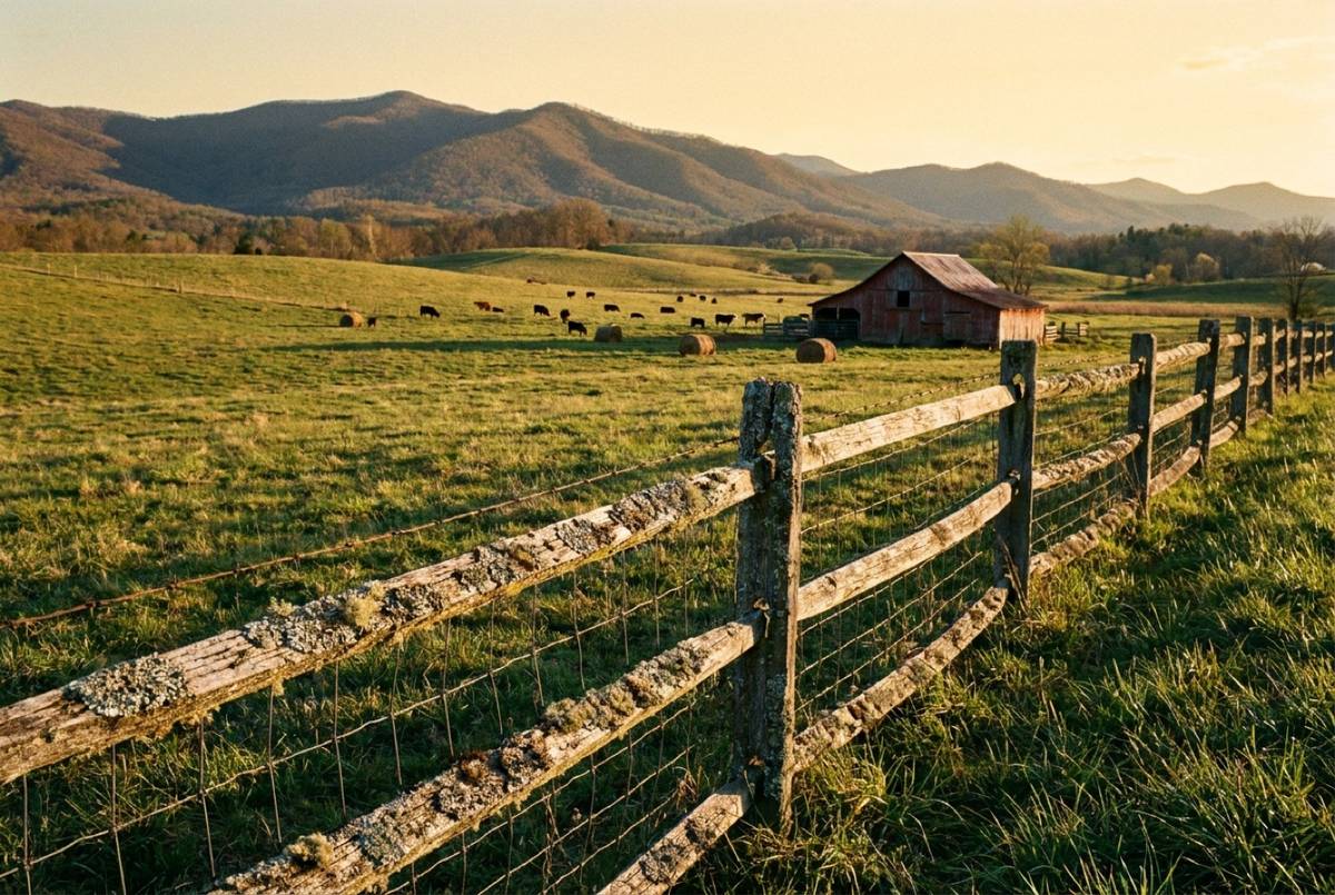
The farm figures are the county's own: a growing season averaging about 180 days, hardiness zone 7a, and 900 farms reported in the 2017 Census of Agriculture. Ground in agricultural, horticultural or forest use can go into the county's Special Assessment Land Program, which asks 5 acres for the first two uses and 20 acres for forest and takes applications from October 1 through November 1 at the Commissioner of the Revenue, 276-730-3080. Carroll County sets its own real estate tax rate, posted by tax year on the Commissioner of the Revenue's adopted rate table, so read the current one there rather than from a listing sheet. Selling working ground starts with how a farm gets priced.
The Woodlawn water system, and where it stops
The Carroll County Public Service Authority runs eight water systems, and one of them is named Woodlawn. Public water here is a line-by-line question, never a county-wide one, so the honest answer on a given parcel is that somebody has to go and check the main. The authority serves about 4,300 customers across the county: Dana Phillips, Assistant Director, 605-2 Pine Street, Hillsville, 276-730-3170.
Woodlawn carries a named sewer system as well: 7,581 feet of 10-inch gravity line, 21,429 linear feet of force main and two pump stations, on Woodlawn and Senior Road. Sewage from Woodlawn and from the Interstate 77 Exit 19 area is pumped to the city of Galax for treatment, so a parcel on public sewer here is tied to a plant in another jurisdiction.
Past the lines it is a well and a drainfield. The county's 2024 plan gives an estimated potential well yield of 20 to 100 gallons per minute, with slow recharge the county puts down to steep surface and low soil absorption. Wells and on-site sewage belong to the Virginia Department of Health: the Carroll County Health Department, 605-15 Pine Street, Hillsville, 276-730-3180, whose environmental health program reviews the soil evaluation and design that a licensed onsite soil evaluator, or a professional engineer in consultation with one, submits, and issues the permit; the professional who certified the design inspects the system at installation. We read the parcel and tell you what to ask; the approvals are theirs to issue. Utilities are one of the five things we read before we price land, and the first thing a builder asks about a lot.
Crooked Creek, and the ground that falls toward it
Four miles south of U.S. 58 at Woodlawn, out Route 620, is Crooked Creek Wildlife Management Area: 1,882 acres of forested and open land taking in parts of Crooked Creek and the East Fork. Virginia DWR notes that much of it was farmland, with old home sites scattered through it, and that the woods are mixed hardwoods with scattered pine.
Elevation on the area runs from 2,400 feet at the streambed to over 3,000 feet, which brackets the relief a buyer meets south of Woodlawn: creek bottom, old pasture and hardwood slope inside a short walk. Ground like that is read piece by piece rather than as an average, because the acre that grows the hay and the acre that can take a drainfield are not always the same one. The county plan supports protecting the Crooked Creek watershed from development, and while no zoning enforces that, a plan says what a county wants.
Crooked Creek carries a fee fishing area, and the seasons, licenses and permits are the Department of Wildlife Resources' to set and to change, so check DWR rather than a listing sheet. The trout water itself, here and across the rest of the county, is in our guide to fishing in Carroll County.
The school building is now a landmark and a gym
Woodlawn School stopped being a school in 2013. Woodlawn School went on the Virginia Landmarks Register in September 2018 and the National Register of Historic Places in January 2019. Its 21-acre campus grew around a two-story brick building finished in 1908, Carroll County's first public high school, and in 1917 an agricultural building behind it housed the state's first vocational agriculture courses, which Virginia's Department of Historic Resources credits with higher farm yields, crop diversification and investment in dairy and beef across the county.
It runs today as a Carroll County Parks and Recreation facility, the Woodlawn School Gymnasium at 745 Woodlawn Road: an indoor gym, indoor walking, pickleball, table tennis and a fitness room inside, a baseball field, a soccer field and picnic tables outside. Posted hours are weekdays 8:00 a.m. to 4:00 p.m. and Saturday open gym, and the county notes they may change seasonally. Bookings go through Parks and Recreation, 129 Ballpark Drive, Hillsville, 276-730-3191.
Woodlawn holds a state park entrance as well: Chestnut Yard, 2588 Iron Ridge Road, Woodlawn, VA 24381, an access point on New River Trail State Park, reached on Route 721 north past Cliffview to Route 607 in the park's own entrance directions. Chestnut Yard is not among the places DCR lists with potable water on the 57-mile trail. The trail itself is in the county trail guide.
No zoning, and one rule that can stop a sale
Carroll County does not zone. The county's economic development office says so plainly, and the 2024 comprehensive plan says it again in its own words. A draft ordinance exists; the Planning Commission voted to table it and its maps until further notice. No zoning does not mean no rules. It moves the limits onto the soil, the access and the plat.
At present, Carroll County does not utilize zoning, and it is important to understand that the Comprehensive Plan is not another name for zoning.
Carroll County, 2024 Comprehensive Plan
What the county does have is a Subdivision of Land ordinance, and it carries the rule that can stop a Woodlawn sale. Any division of a lot or parcel counts as a subdivision, and no owner or agent may sell a parcel out of a proposed subdivision before the plat has been approved and recorded in the Circuit Court Clerk's Office, though the ordinance adds that nothing in it prevents "the recordation of the instrument by which the land is transferred or the passage of title between the parties to the instrument". A plat going to the Planning Commission has to reach Land Use and Planning ahead of its meeting, by a deadline to confirm with that office.
The county Web GIS shows a parcel and its lines without a login, and the county's own warning on that map is the honest one: recorded plats and deeds, not the map, are authoritative for legal acreage and ownership. Selling here runs on the same five steps as every listing we take, set out on the land selling page.
Two records settle a Woodlawn parcel, because there is no town line here to do it for them: whether the tract carries an approved, recorded plat, and whether the Woodlawn main reaches the frontage or the ground is on a well. Tell us the road, and whether it fronts U.S. 58 or sits back on a state route. Lowell will walk it and pull both, and what comes back is a free land and home valuation, at no cost and no obligation.
Current listings
Status and price come from the SW VA Association of REALTORS MLS record at every build; a listing that leaves the market leaves this page the same day.
No active Bowman Real Estate listings in Woodlawn right now. Lowell knows what is about to come on the market here; ask him, or see every current listing.
Ask about Woodlawn property
Send a few details and Lowell will come back with an honest read. No cost, no obligation.
Got it. Thank you.
We'll be in touch shortly with an honest read.
Good questions, straight answers.
Is a Woodlawn parcel on county water, or does it need a well?
Either, depending on the parcel. The Carroll County Public Service Authority runs eight water systems and one of them is named Woodlawn, so public water here is a line-by-line question rather than a county-wide one. Past the mains it is a private well, and the county's plan puts estimated potential well yield at 20 to 100 gallons per minute. Call the authority at 276-730-3170 with the address.
Carroll County has no zoning. Can I split a Woodlawn tract and sell off a piece?
Not until the plat is done. The county has no zoning ordinance, but its Subdivision of Land ordinance treats any division of a lot or parcel as a subdivision, and no owner or agent may sell a parcel out of a proposed subdivision before the plat is approved and recorded in the Circuit Court Clerk's Office. The ordinance adds that nothing in it prevents "the recordation of the instrument by which the land is transferred or the passage of title between the parties to the instrument". Start with Land Use and Planning at 276-730-3008.
What is the old Woodlawn School used for now?
Recreation. The school closed in 2013 and the building is now the Woodlawn School Gymnasium, a Carroll County Parks and Recreation facility at 745 Woodlawn Road, with an indoor gym, indoor walking, pickleball, table tennis and a fitness room, plus a ball field, a soccer field and picnic tables outside. The campus is a listed landmark on the state and national registers.
How do I reach Crooked Creek from Woodlawn, and what is the ground like out there?
Take Route 620 south off U.S. 58 at Woodlawn and go four miles. Crooked Creek Wildlife Management Area covers 1,882 acres of forested and open land, much of it former farmland with old home sites still scattered through it, and elevation on the area runs from 2,400 feet at the streambed to over 3,000 feet. Private tracts south of Woodlawn carry that same relief. Fishing seasons and permits are set by the Department of Wildlife Resources and change, so check with them.
Where this page's facts come from
Every rule, office and figure above traces to one of these. Rules change; check the office before you act on one.
- Geographic Names Information System, Virginia domestic names (Woodlawn, feature 1476952) U.S. Geological Survey
- Elevation Point Query Service at the Woodlawn point U.S. Geological Survey
- Elevation Point Query Service at the Pike Knob point U.S. Geological Survey
- 2024 Gazetteer places file for Virginia (Woodlawn CDP) U.S. Census Bureau
- 2024 Comprehensive Plan Carroll County, Virginia
- Economic Development Authority: no zoning Carroll County, Virginia
- Department of Land Use and Planning: subdivision of land Carroll County, Virginia
- Subdivision of Land ordinance, amended through April 14, 2014 (PDF) Carroll County, Virginia
- Planning Commission: meetings and the tabled zoning ordinance Carroll County, Virginia
- Building Official, erosion and sediment control Carroll County, Virginia
- Public Service Authority: county water and sewer Carroll County, Virginia
- Commissioner of the Revenue: adopted 2026 tax rates Carroll County, Virginia
- Special Assessment Land Program for agricultural, horticultural and forest use Carroll County, Virginia
- County Web GIS parcel viewer Carroll County, Virginia
- Woodlawn School Gymnasium Carroll County, Virginia
- Parks and Recreation Carroll County, Virginia
- Crooked Creek Wildlife Management Area Virginia Department of Wildlife Resources
- Woodlawn School, DHR 017-5160 Virginia Department of Historic Resources
- New River Trail State Park Virginia Department of Conservation and Recreation
- New River Trail entrance directions, including Chestnut Yard Virginia Department of Conservation and Recreation
- Districts and residencies, including the Martinsville Residency Virginia Department of Transportation
- Mount Rogers Health District locations, including Carroll County Virginia Department of Health
- Mount Rogers environmental health: private wells and on-site sewage Virginia Department of Health