Galax VA real estate:land, homes and farms on both sides of the city line.
Galax is an independent city between Carroll and Grayson counties, with its own planning office, its own building official and its own water. Which side of the city line a parcel sits on decides who reviews the plat, who runs the pipe and which rate book it is taxed from.
Where the city sits, between two counties
The pin marks the Galax town point recorded by USGS, at 2,368 feet. The city covers about 8.2 square miles between Carroll County and Grayson County. The city line itself is not drawn on this map, so confirm a parcel's jurisdiction with the city or the county before you rely on it.
Galax, Virginia: 36.6612 N, 80.9240 W. Open this spot on OpenStreetMap.
Map tiles by Esri with OpenStreetMap data. Pins mark the town, not a parcel; ask Lowell for a parcel map.
Galax is a city, and the line is the first fact about the ground
Galax is an independent city. It sits between Carroll County and Grayson County, and it has been a separate and distinct jurisdiction from both adjoining county governments since 1953. About 8.2 square miles, roughly 5,262 acres, answer to the city and to neither county. Even the state's historic register files property here under its own label, Galax (Ind. City).
The City of Galax is an independent city, incorporated in 1953 as a separate and distinct jurisdiction from its adjoining county governments
City of Galax comprehensive plan
The line decides who reviews the plat, who issues the permit, who runs the pipe and which rate book the parcel is taxed from. Almost every Galax VA real estate question runs through it, so the first thing we settle on an address here is which side of the line the ground is on. We work both sides of it.
| What you are asking | Inside Galax | Just outside, in Carroll County |
|---|---|---|
| Zoning | Chapter 160 of the Code of the City of Galax, adopted November 12, 1985 | No zoning. The county's economic development page states it plainly |
| Subdivision plats | The Galax Zoning Administrator; a major plat goes to City Council | Carroll County Land Use and Planning, and no parcel may be sold out of a proposed subdivision before the plat is approved and recorded |
| Streets | Maintained by the city, with partial VDOT funding | Managed and funded by VDOT, Salem District |
| Water and sewer | The city system, available to practically all areas inside the limits | A county line where one reaches, a well and septic where it does not |
| Real estate tax | Assessed at 100 percent of value, at the rate the city Commissioner of Revenue publishes | The county's own adopted rate for the tax year, on the Commissioner of the Revenue's schedule |
| Building permits | The Galax Building Official, 111 East Grayson Street | The Carroll County Building Official, Hillsville |
Two arterials in, and the interstate nine miles east
State Route 89, which is Main Street, and U.S. Route 58-221, which is Stuart Drive, are the primary arterial roads serving Galax and the main entrances to the city. The city's plan puts Galax approximately nine miles west of Exit 14 on Interstate 77, reached on U.S. Highway 58.
Access splits at the line like everything else. Streets inside Galax are maintained by the city, with partial funding provided by the Virginia Department of Transportation, so a new entrance on a city street is a city conversation. On a county road outside the limits the entrance permit is VDOT's, and the city and Carroll County sit in the same Salem District. General aviation is at Twin County Regional Airport, 11 miles northeast of Galax and physically in Carroll County.
Chestnut Creek is the water supply, the floodplain and the trailhead
Chestnut Creek runs through Galax on its way to the New River, and it is where the city's drinking water comes from: a source the city describes as several smaller streams. It is also where New River Trail State Park begins.
Virginia DWR marks this as the beginning of the trail and puts the Galax trailhead at 2,300 feet. The park's own entrance directions give the address as 212 East Stuart Drive, with parking where Route 58 crosses Chestnut Creek. DCR lists Galax among the points on the 57-mile trail with potable water, and horses are allowed except on the two-mile section between Galax and Cliffview. DWR describes the habitat here as primarily open, regenerating fields rather than deep woods. The county's share of the trail is on our Carroll County trails guide.
Elevation, grade, and the acres nobody built on
USGS puts the Galax town point at 2,368 feet and the Census interior point of the city at 2,459 feet. Ninety feet of difference inside one small city is a fair measure of how much this ground rolls.
The city's plan is blunt about what that costs. Approximately 11 percent of the land in Galax has slopes in excess of 20 percent, roughly a third of the undeveloped land is steep, and 1,179 acres, 22.3 percent of the city, were still undeveloped at the 2021 land use inventory. The city adds that only a small portion of that steep land has been developed.
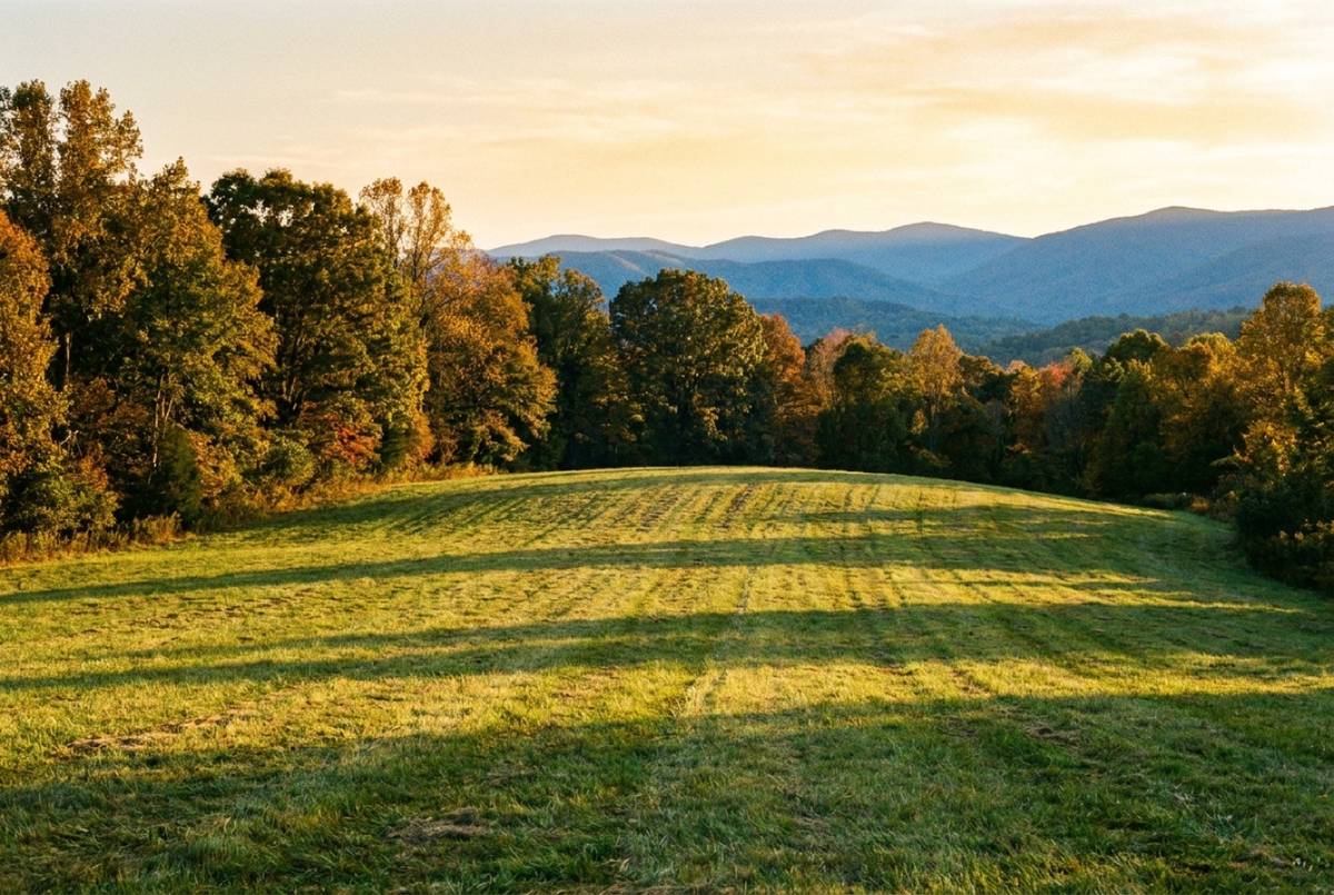
Crossing the line does not flatten anything. Carroll County's own 2024 comprehensive plan puts slightly more than half of the county's land area over 20 percent slope, and what that grade costs a buyer on county ground is the subject of Woodlawn VA real estate. If you are selling land in this area, grade and access are what the price gets built on; if you are buying to build, start with what a builder needs to see in a lot.
The city runs its own water and sewer, and both cross the city line
Galax owns and operates a municipal water and wastewater treatment system, and service from both is available to practically all areas within the city limits. The water system serves greater than 95 percent of residents and 100 percent of businesses and industries in the city, and both plants run at or under half of their rated capacity.
So the city is a wholesaler as well as a utility. Carroll and Grayson counties are both customers of the Galax water system, Carroll for the Tower Road system and Grayson for the Fairview and Oldtown areas, and the Galax wastewater plant treats sewage piped in from county systems that reach Woodlawn, the Interstate 77 Exit 14 interchange, the Wildwood Commerce Park area, Airport Road and Fancy Gap.
The city's published water and wastewater rate table is headed Rates Inside Corporate Limits, so service beyond the line is priced separately: ask the city rather than assume the posted figure carries. Where no public line reaches, a parcel needs a well and an onsite septic system, permitted by the Virginia Department of Health through the Galax City Health Department at 502 South Main Street, (276) 236-6127. Inside the city the utility answer also sets the lot: zoning authority here expressly includes minimum lot sizes based on whether public or community water and sewer are available and used.
Construction, zoning and land use sit in one city office
If you own ground inside Galax, the first call is Galax City Engineering at 111 East Grayson Street, (276) 236-2422. One city office carries construction, zoning, land use, planning, geographic information and city building and property maintenance. Douglas Williams, AIA, its Director of Planning and Community Development, is also the Zoning Administrator.
- Plats, rezonings and special use permits. The Zoning Administrator handles rezoning, special use permits, variances, sign permits, site plan review and subdivision plats. Rezonings, special use permits and major plats go to City Council.
- Permits and inspections. Thomas Hager is the Building Official, (276) 236-7297, and that desk also issues certificates of occupancy and floodplain permits.
- Land disturbance and stormwater. Adrienne Norman is the Environmental Program Manager, (276) 236-7380.
- Assessment. Rene' H. Funk is the Commissioner of Revenue, (276) 236-2528. City real estate is assessed at 100 percent of value, and that office publishes the current schedule of rates and fees.
- A new address or road name sign. Twin County E-911 is the 911 answering point for Carroll County, Galax and Grayson County, from the Harold Snead Public Safety Building on North Main Street, and its page lists a sign and addressing technician; confirm with that office or the locality who assigns the address for a given parcel.
The ordinance itself is Chapter 160 of the Code of the City of Galax, adopted November 12, 1985 with later amendments, running from residential through business to industrial districts. We do not print a district count, because the city's own plan gives a number and then lists a different number of districts by name; ask the Zoning Administrator which district a parcel is in and take the answer from the office that enforces it.
Commercial buyers meet one more rule: a new or relocating business must have the Zoning Ordinance and Building Code Review Application completed and approved before applying for the business license. Zoning clearance first, license second, which is worth raising before a contract rather than after. It shapes how we market commercial property in this area too. Parcel lines and districts are on the city's WebGIS viewer, though as Carroll County's own Web GIS warns, recorded plats and deeds are the authoritative source for legal acreage and ownership.
Felts Park, the Music Center and the East Stuart Drive corridor
Buyers ask what is actually here. These are places, each one a fixed address that shapes the ground around it.
Felts Park is a 28-acre public recreation facility at 601 South Main Street, with the Galax Recreation Center beside it, a half-mile paved walking track and a 3,000-seat covered grandstand. The Old Fiddlers' Convention has been held there since the fall of 1935, when it outgrew indoor facilities. The nearest Blue Ridge Parkway destination is the Blue Ridge Music Center at Milepost 213, which the National Park Service puts 10 miles out by way of Interstate 77 and Route 89, with a 3,000-seat outdoor amphitheater and two trails. The Parkway's 30 miles through the county are on our Carroll County Parkway guide.
East Stuart Drive is the working corridor: Twin County Regional Healthcare, a 141-bed hospital, and Wytheville Community College's Crossroads Institute at 1117 East Stuart Drive, which shares that address with the Twin County Chamber of Commerce. The chamber represents Carroll, Grayson and Galax together, which is why so much here carries the Twin County name: the chamber, the hospital, the regional airport and the E-911 center all cover the two counties and the city that belongs to neither. Downtown, laid out on a gridiron plan of rectangular blocks, is the Galax Commercial Historic District, most of it built between 1920 and 1940 and listed on both the Virginia Landmarks Register and the National Register of Historic Places.
A city lot, or county ground a mile out
Two parcels can be a few minutes apart and answer to different governments, different rate books and different pipes.
Inside the line
The utilities and the zoning district are usually settled at the street already, so the question moves straight to the ground, and the ground still open inside the city is the steep ground. A level lot with water and sewer at the road is the scarce item, and it should be priced as one.
A mile outside it
Carroll County ground has no zoning ordinance at all, which is freedom and risk in the same sentence. What still governs is the county's Subdivision of Land ordinance, and the plat has to be approved and recorded before a parcel out of a proposed subdivision changes hands. Entrances are VDOT's, water is a county line where one reaches and a well where it does not, and the office behind each of those answers is on our six counties page. On the Grayson side of the city they change again, so ask before you assume a Galax answer carries. Working ground gets the same read on either side, whether you are buying it or selling farm ground.
Send the address, or the tax map number if you have it, and we start with which side of the line the parcel is on. After that it is the same read we give any parcel, and how we read land sets that out in full. It is worth being exact here. The city that treats the sewage from Woodlawn, the Exit 14 interchange and Fancy Gap is the same city whose line you may be standing one field outside of, and the two sides of it do not price the same.
Current listings
Status and price come from the SW VA Association of REALTORS MLS record at every build; a listing that leaves the market leaves this page the same day.
No active Bowman Real Estate listings in Galax right now. Lowell knows what is about to come on the market here; ask him, or see every current listing.
Ask about Galax property
Send a few details and Lowell will come back with an honest read. No cost, no obligation.
Got it. Thank you.
We'll be in touch shortly with an honest read.
Good questions, straight answers.
What does the Chestnut Creek floodplain mean for a parcel in Galax?
A 100-year floodplain bisects the city along Chestnut Creek. The city says flooding has not been a major concern there since the 1950s, and still says development in that area should be limited. Fill, excavation or any man-made change inside the floodplain needs a permit from the Galax Building Official at 111 East Grayson Street, (276) 236-7297. FEMA floodplain information for a specific parcel comes from the city's GIS Coordinator, so check the parcel before you plan around it.
Does city water and sewer reach every lot inside Galax?
Close to it. The city says service from both systems is available to practically all areas within the city limits, and the water system serves greater than 95 percent of residents and 100 percent of businesses and industries. Outside the limits it is a different question: the published rate table is headed Rates Inside Corporate Limits, and a parcel with no line reaching it needs a well and an onsite septic permit from the health department.
Why do two parcels a mile apart carry different real estate tax rates?
Because they sit in different jurisdictions with different assessing offices. Galax assesses city real estate at 100 percent of value, under the rate on its Commissioner of Revenue's current schedule of rates and fees. Carroll County publishes its own adopted rate for each calendar tax year on its Commissioner of the Revenue's page. Neither office assesses the other's ground, so read the schedule published by the one that governs the parcel.
What is at the Galax end of the New River Trail?
The southern terminus. The park gives the Galax entrance as 212 East Stuart Drive, with parking where Route 58 crosses Chestnut Creek, and Virginia DWR puts the trailhead at 2,300 feet. DCR lists Galax among the points on the 57-mile trail with potable water, and horses are allowed except on the two-mile section between Galax and Cliffview. For fishing and hunting rules anywhere along it, check DWR.
Where this page's facts come from
Every rule, office and figure above traces to one of these. Rules change; check the office before you act on one.
- Comprehensive Plan, 2022 Amendment 1, adopted January 8, 2024 (PDF) City of Galax
- Zoning and Land Development City of Galax
- City Engineering: construction, zoning, land use, planning and GIS City of Galax
- Building Official City of Galax
- Commissioner of Revenue: schedule of rates and fees City of Galax
- Water and wastewater rates City of Galax
- Twin County E-911 and addressing City of Galax
- City of Galax WebGIS parcel viewer City of Galax
- Galax (Ind. City) register properties Virginia Department of Historic Resources
- Galax Commercial Historic District, 113-5001 Virginia Department of Historic Resources
- New River Trail State Park Virginia DCR
- New River Trail State Park entrances and directions (PDF) Virginia DCR
- New River Trail State Park, Galax (Virginia Bird and Wildlife Trail) Virginia DWR
- Geographic Names Information System, Virginia domestic names USGS
- Elevation Point Query Service, Galax town point USGS
- 2024 Gazetteer, Virginia places U.S. Census Bureau
- Blue Ridge Music Center, Milepost 213 National Park Service
- History of the convention Old Fiddlers' Convention
- About the hospital Twin County Regional Healthcare
- The Crossroads Institute, Galax Wytheville Community College
- Carroll, Grayson and Galax chamber Twin County Chamber of Commerce
- Airport information Twin County Regional Airport
- Districts and residencies VDOT
- Mount Rogers Health District locations Virginia Department of Health
- 2024 Comprehensive Plan (PDF) Carroll County
- Land Use and Planning: subdivision of land Carroll County
- Commissioner of the Revenue: adopted 2026 tax rates Carroll County
- Building Official Carroll County
- Economic Development Authority: no zoning Carroll County
- Web GIS parcel viewer Carroll County